
A County Camera Is Watching a Children’s Soccer Field
We went looking for New Hanover County’s still-hidden Condor cameras and found the second one. It is not aimed at a highway or a crime scene. It sits on a pole at Veterans Park, and it is pointed at a field where children play soccer.
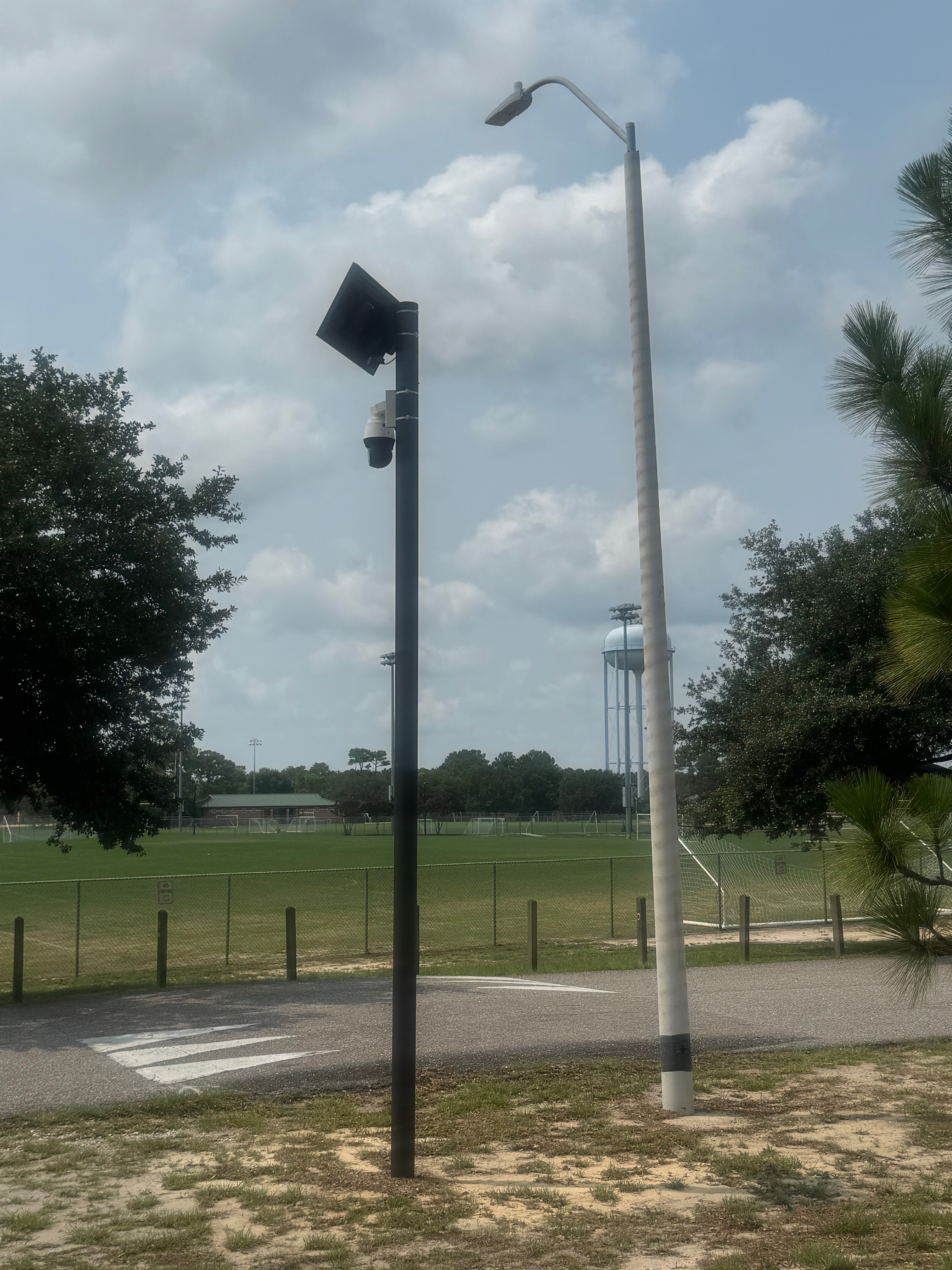
This is the camera the Sheriff’s own memo does not describe. In his memorandum to the county commissioners, Sheriff McMahon calls the county’s Flock system a license plate reader — cameras that “photograph the rear of vehicles only” and collect “limited vehicle-related information.” The device on this pole is a Solar Condor PTZ: a live-video camera that pans, tilts, zooms, and can lock onto and follow a person. Eight of them are line-itemed in the county’s own contract. This is the second to surface.
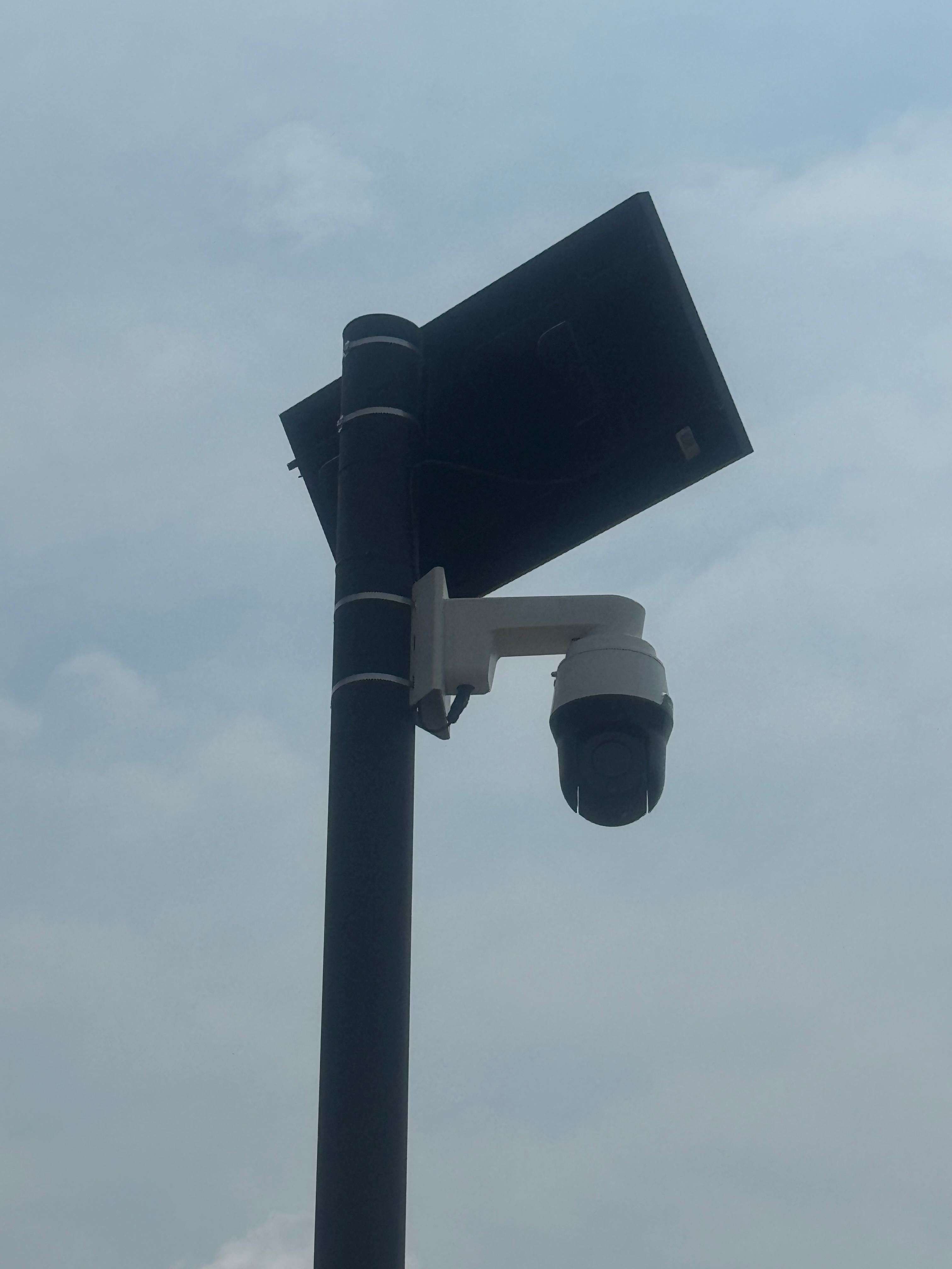
Where it is
The camera stands beside the Pleasure Island Soccer Association fields at Veterans Park, off Pilots Ridge Road in Myrtle Grove — GPS 34.103778, −77.904627 (open the map). It faces the fields. Veterans Park is a 212-acre county complex that also contains Ashley High School, Murray Middle School, and Anderson Elementary School. On a weekend, this is one of the busiest youth-sports sites in the county.

Why a camera here is different
A plate reader on a highway records cars. A pan-tilt-zoom camera over a soccer field records children — and the adults who bring them. Flock’s Condor is built to search for people by description and to track a figure across a scene on its own. We are not alleging misuse of this camera. We are pointing at capability and placement: the county has mounted a live, movable, AI-assisted eye over a place where families gather — on a system where officers in other states keep getting caught using the cameras to follow individuals, and where the only safeguard is an internal audit, once a year, performed by the agency on itself. We wrote about this exact risk before we knew this camera existed: a camera watching the playground.
And it does not appear to be answering a crime wave
By the data we reviewed, the Myrtle Grove area appears to be a low-crime part of the county — publicly reported crime rates there run well below the national average and far below the City of Wilmington. On those numbers, the placement is hard to justify on public-safety grounds. What is not hard to measure is the cost: county taxpayers fund a roughly $219,000 Flock contract, and part of what that money bought is a live-video camera trained on children playing soccer. In our view, it makes little sense to spend public money watching a low-crime recreation field — and it is exactly the kind of decision a public body should have to make in the open, before the camera goes up, not after a resident finds it from the roadside.
This is the proof the “plate reader” framing is wrong
When the Sheriff tells commissioners the system “photographs the rear of vehicles only,” this camera is the answer. It photographs people. It is one of eight, most still hidden, and the county redacts where they are. That is the whole reason residents are mapping them from the public sidewalk — so the public can see what its own government has already put up.
This camera is now on the public DeFlock map. Three of the eight Condors are still out there (see them all on the map). Here is how to find one near you — and the commissioners who fund all of it meet regularly — see upcoming meetings.
You’re not a suspect. So stop being tracked like one.
It takes one minute. Add your name — then tell the officials who represent you to take the cameras down.