Map the Cameras Watching New Hanover County
Officials won’t tell us where all the cameras are — locations were redacted in the records they released. So residents are mapping them ourselves.
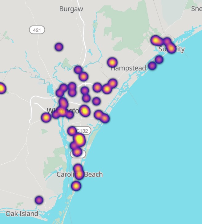
There’s a free, open tool for this: maps.deflock.org, the crowdsourced map run by the national DeFlock project. It’s built on open data (OpenStreetMap), and anyone can use it — or add to it.
How to use it
- Find cameras near you: open the map, zoom to Wilmington and New Hanover County, and see what’s already been pinned.
- Report a new one: when you spot a camera that isn’t on the map, add it — note the pole, the direction it faces, and the cross-streets.
- Check before you assume: the map shows multiple vendors, not just Flock — the surveillance is bigger than one brand.
Why this matters
When the Sheriff’s Office released its records, the camera locations were blacked out. A public, crowdsourced map is the closest thing we have to an honest count — and the more residents who contribute, the clearer the picture of just how blanketed our county has become. It’s citizen accountability, one pin at a time.
You’re not a suspect. So stop being tracked like one.
It takes one minute. Add your name, then tell your county commissioners to cancel the Flock contract.